
Walk a Marana Street by Address
A street directory search answers several distinct questions. The Pima Assessor identifies the indexed owner and the parcel tied to a situs, which means the physical property address. PimaMaps shows that parcel beside nearby lots. The Recorder adds dated owners and land instruments. An authorized voter record or a reverse directory may add occupant evidence, while permits can identify applicants and work at the address. None of those sources alone lists a whole household.
- Verify the address and county. A USPS Marana label can sit outside the Town or near the Pinal County edge.
- Search the Pima Assessor by property address. Copy the parcel code, owner, situs, mailing address, legal description, and current recorded-document reference.
- Open the parcel in PimaMaps. Click the subject and nearby lots, then follow More Information to each Assessor detail page.
- Use the current deed reference in the Pima Recorder index. Trace parties and the same legal parcel rather than searching the street text alone.
- Check lawful voter access, requested permit files, and available criss-cross directories for dated occupant evidence.
This sequence turns a loose street name into linked records. The parcel number is the bridge. It keeps the Marana street directory aligned even when an address has a new ZIP, a different preferred city, or an older rural description.
Marana Street Search Fields
The Pima County Assessor search supports more than a basic address box, and its direct parcel-search form exposes the working routes.

The portal can move from a Marana street address to a parcel detail card. Save every stable identifier before leaving the result.
| Field or mode | Format | Street-directory use |
|---|---|---|
| Property Address | Street number and name; normalize direction and suffix | Find the subject parcel |
| Parcel Code | Exact county parcel number | Reopen the same legal lot |
| Property Owner | Indexed surname, trust, or entity | Find other property entries |
| Map and Plat | Recorded map or plat parts | Browse a subdivision’s lots |
| Recorded Document | Recorder sequence | Join a parcel to its deed |
| PLSS or Subdivision | Survey fields or recorded name | Search rural or planned Marana land |
The returned parcel card may include owner name, tax-mailing address, situs, legal description, values, property class, acreage, building characteristics, sale or document references, and map links. The roll omits renters and many household members. A trust or company name may require the deed and Arizona entity filings to identify the legal parties.
Note: Match both parcel number and legal description before treating two Marana address records as the same property.
Map Marana Streets Parcel by Parcel
PimaMaps supplies the spatial half of the street directory. Search or zoom to one known address, turn on parcel boundaries, click the lot, and follow More Information. The county's GIS parcel-search guidance explains the links among map results, parcel detail, and Assessor images. Useful layers include aerial photos, streets, subdivisions, incorporated limits, zoning, floodplain, districts, and other county themes.
Open the PimaMaps parcel viewer to inspect a Marana street.

The map view makes it practical to click consecutive parcels rather than run a broad name query. Zoom closely enough to separate lots. A parcel facing the subject across a street may be nearby without sharing a legal boundary. Washes, highways, and subdivision walls can also make a simple radius misleading.
Map controls include search, identify, layer toggles, zoom, pan, measure, legend, print, and basemap choices. Measurement gives context only. It does not establish a legal boundary. The recorded plat and legal description control that question.
Marana GIS Address Range Search
The county also exposes a landbase search built for taxpayer, parcel-code, street-number, and address-range work. It is useful when one exact street record is missing or a segment needs to be explored. The tool can narrow the street number and name before the researcher opens parcel detail.
See the Pima GIS address and parcel search for its live fields.
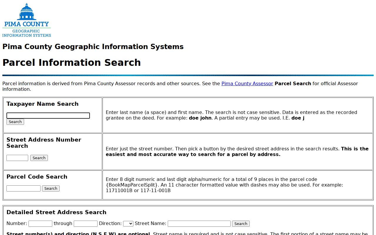
The address-range screen offers a second route when spelling, direction, or suffix creates trouble in the Assessor portal. Test the normalized street form, then use the resulting parcel code in the main viewer. Do not infer a resident from the map alone.
Marana Records Keyed by Street
Address-based records overlap without being interchangeable. The Marana street directory becomes reliable when each source is used for its intended purpose and dated correctly. Current owner, current occupant, past owner, applicant, and voter are different roles.
| Record Set | Keeper | What It Shows | Access |
|---|---|---|---|
| Parcel roll | Pima County Assessor | Owner, mailing and situs addresses, parcel, legal description, values | Free address, owner, parcel, and land searches |
| GIS parcel map | Pima County GIS | Lot geometry, adjacent parcels, jurisdictions, streets, and layers | Free PimaMaps viewer |
| Recorded instruments | Pima County Recorder | Dated grantors, grantees, deeds, liens, plats, and legal parcel references | Free index and watermarked images; clean copies paid |
| Voter information | Arizona and Pima Recorder | Authenticated voter data or authorized extract fields | Self-service or statutory request under A.R.S. §16-168 |
| Permits and code | Town of Marana | Project address, applicant, contractor, dates, scope, and public status | Records request during CityView transition |
| Reverse directories | Pima County Public Library and archives | Listed occupant or telephone at sequential older addresses | Reference shelf; Infoline up to three lookups |
| Released census | National Archives and library databases | Historical households and nearby enumeration entries | Public through 1950 |
The parcel code joins the Assessor, GIS, tax, and recorded-document references. The legal description protects the chain when the postal string changes. Occupant sources then answer the question the land roll cannot.
- Parcel
- A mapped and indexed unit of land used by county property systems.
- Situs address
- The physical location of the parcel, distinct from the tax mailing address.
- Plat
- A recorded map that lays out a subdivision, lots, roads, and related land details.
- Criss-cross directory
- A volume arranged by street address or phone number so nearby entries can be read in sequence.
Marana Deeds Follow Legal Land
Recorded deeds are indexed most reliably by party and land reference, not by a modern street directory string. Start with the current Assessor deed reference. In the Recorder result, capture grantor, grantee, recording and execution dates, sequence or book and page, and legal description. To move backward, search the seller as an earlier grantee and confirm the same parcel.
The Pima Recorder’s county holdings date to 1865, and online indexing is complete from June 1982 forward. Older indexing and images remain incomplete online as the historic project advances. Free document images are unofficial and watermarked. Clean or certified copies follow the Recorder's published copy and certification fees.
If the online index stops, use a citation carried by a later deed, visit an office kiosk, call 520-724-4350, or mail a focused request. The research office at 240 N. Stone Ave. in Tucson is open weekdays from 8 a.m. to 5 p.m. Those channels keep an older Marana street trace moving without inventing a missing transaction.
Note: A deed of trust records a secured loan interest and should not be mistaken for a transfer of ownership.
Marana Mailing and Situs Clues
A tax mailing address can match the situs and support an owner-occupancy hypothesis. It still does not prove occupancy. A different mailing address might belong to an owner elsewhere, but it may also be a post office box, trust, manager, or old preference. Renters and other household members are normally absent from the parcel card.
This is one of the most common street-directory mistakes. The Assessor was built to administer property, not count each person behind a door. Use its owner name as a precise lead, then seek dated occupant evidence in a lawful voter record, reverse directory, census, or other record made for that purpose.
Owner is not occupant. A Marana parcel name identifies the assessed owner role. It is never a complete household list.
Marana Permits During CityView
Town permit and code records can tie an address to an applicant, contractor, owner, scope of work, dates, valuation, or public case status. The Town archive does not contain every permit or plan. Those files use the general public-record route, while police and court files have separate channels.
The Marana Customer Portal announcement dates the CityView rollout to summer 2026.
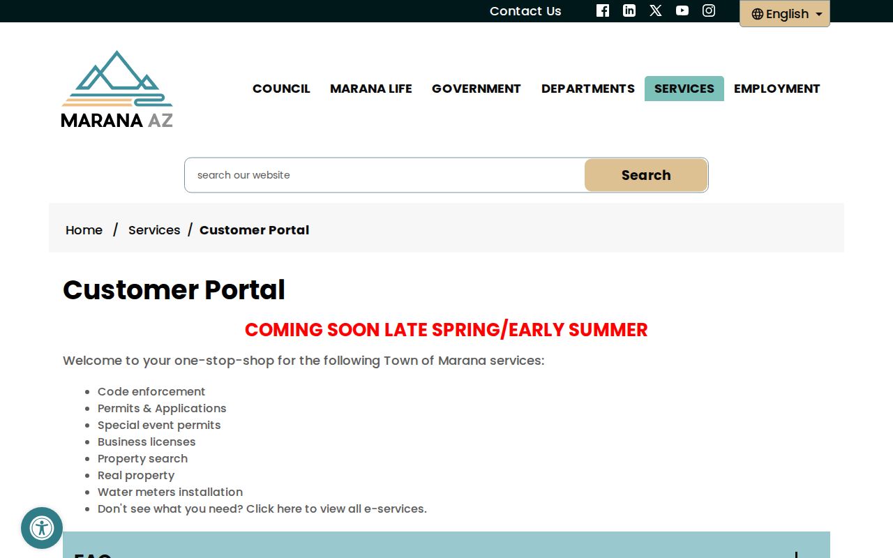
The announced service combines code enforcement, permits, applications, special events, business licenses, property-related work, and water-meter tasks. Secure accounts and status notices apply to many submissions. During the transition, keep the Town Clerk’s public-record request, the relevant department, phone contact, and a precise address-and-date request as fallbacks.
Marana Voter Street Limits
Arizona's official voter-services route leads to an authenticated voter portal for one's own registration, districts, notices, ballot status, and participation history. It is not an anonymous by-street browser. A formal Pima County extract uses the Recorder's voter-data request form and can include residence address, registration date, precinct, party, telephone if available, and selected geography. The requester must declare an authorized use, pay the stated fee, and comply with A.R.S. §16-168.
Full birth dates, Social Security numbers, license and state-ID numbers, signatures, and protected addresses are not ordinary public directory fields. The Address Confidentiality Program and voter protections can suppress a residential address. Participation data says whether and by what method a voter participated, not how the person voted.
When only civic geography is needed, use the Pima Elections address locator. Its address field, with optional direction, suffix, and ZIP, returns precinct and many districts plus incorporated or unincorporated status. It resolves jurisdiction without exposing resident names.
Historic Marana Streets Run in Reverse
Reverse or criss-cross directories reorder entries by street and address. They can show a listed occupant and nearby numbers, which makes them more useful to a historical street directory than an alphabetical surname volume. Pima County Public Library keeps Cole and Polk directories, telephone books, and related microfilm at Joel D. Valdez Main Library.
PCPL Infoline at 520-791-4010 will perform up to three address or telephone lookups for a remote researcher. Available Tucson and Pima County directory editions begin with 1881 and run through existing years to 2003 across the library, Arizona Historical Society, and online collections. Not every year was published, and some reverse volumes were rented and later returned.
A directory occupant can differ from the deed owner. That difference may reveal a renter or relative. Use the Marana city directory collection for the full shelf and reading method, then bring only the relevant address entry back to the parcel chain.
Marana Street Labels Cross Boundaries
A preferred mailing city, Town limit, county line, ZIP area, and records jurisdiction can all describe different geographies. Most Marana property is in Pima County, but the northern edge may require a Pinal County check. Some incorporated parcels carry a Tucson mailing city, while broad Marana delivery areas extend beyond compact town development.
New master-planned streets can postdate printed directory runs. Older rural records may use routes, landmarks, subdivision plats, or township, range, and section. No verified mass Marana renumbering year was found. Bridge old and new descriptions with the parcel number, recorded plat, legal description, dated Assessor maps, and the specific directory edition. Never invent a renumbering event to explain a gap.
Limits of Marana Street Records
A Marana street directory cannot provide a live or complete roll of occupants. Renters and household members often do not appear on the property roll. Utility accounts, delivery data, motor-vehicle addresses protected by federal law, sealed court records, juvenile data, victim and witness details, and protected voter addresses remain closed. Community associations may publish officers or event contacts, but no official public member or household roster was verified.
Public records also age. A deed is true for its recording event. An assessment roll reflects its valuation cycle. A directory captures its edition, and a permit names the participants in that file. Compare dates and roles before drawing a conclusion. Correct an error with the source custodian instead of repeating it.
Lawful use. Marana address records are available for legitimate personal research, genealogy, property questions, and civic understanding. Never use them to stalk, threaten, intimidate, harass, or harm anyone.
A careful by-address search accepts those boundaries. A protected absence is a safety feature. It should not be treated as a puzzle to defeat.